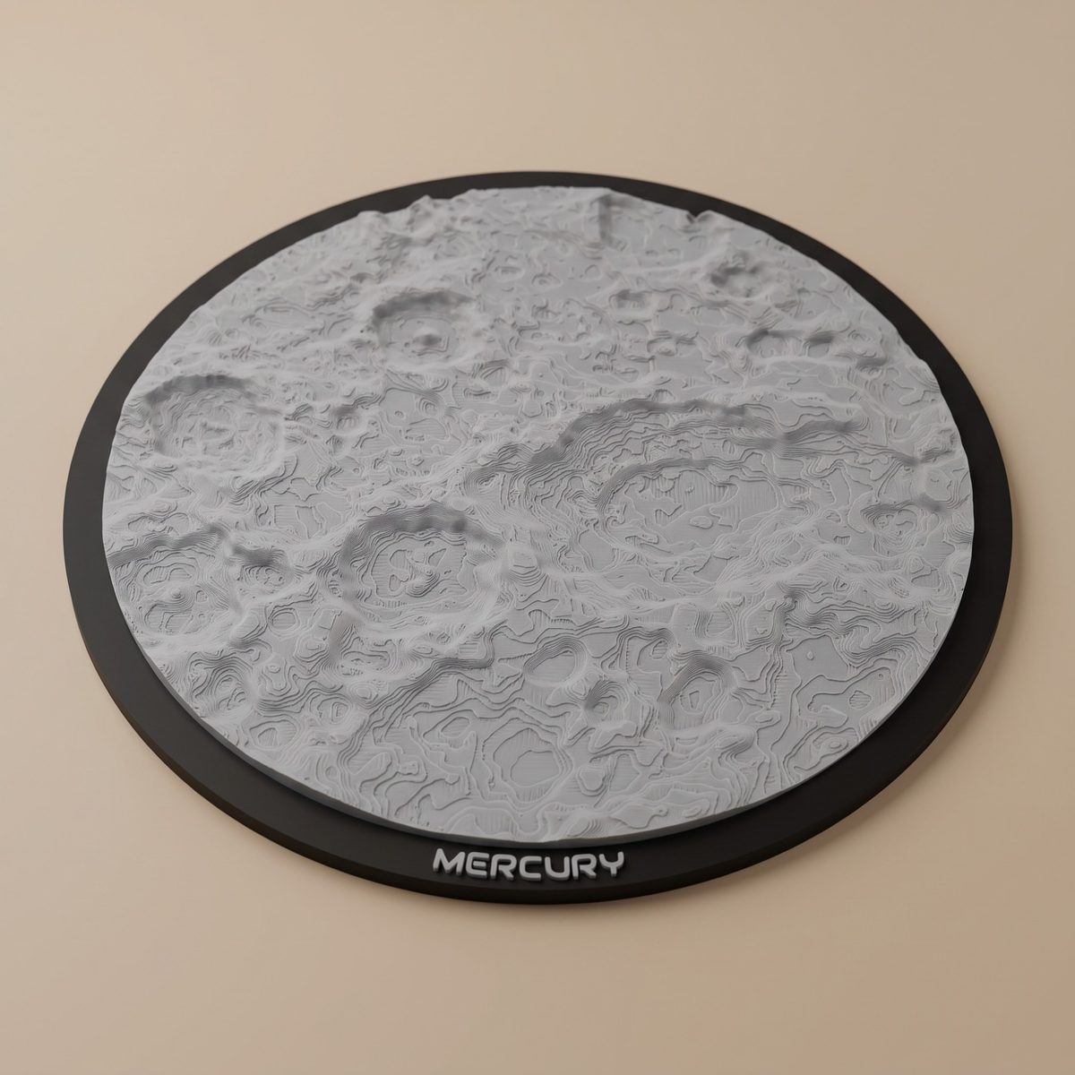
How do you turn a region of Mercury into an STL?
Open the generator, switch it to Mercury, pick a landmark from the list or drag the selection box over any other region, and choose a jigsaw puzzle or a solid ornament in a circle, square or hexagon. OrbitStudio builds the model from the elevation data and shows it in 3D before you download anything, with the terrain and the frame already separated and colored.
Generating a model and turning it around in 3D is free and needs no account. A free account adds puzzle slicing, custom frame text and a library of three models. Downloading the STL and pre-colored 3MF files uses one credit from a pass.
How much relief does Mercury have?
Nearly 10 kilometers from the lowest point to the highest in the first global elevation model of Mercury, which the USGS built from MESSENGER's images. The floor of Rachmaninoff basin lies 5,380 meters below Mercury's average elevation, and the highest point, in some of the planet's oldest terrain just south of the equator, stands about 4,480 meters above it. Long cliffs called lobate scarps, such as Discovery Rupes, cross the surface: they rose as the planet's interior cooled and shrank, by as much as 7 kilometers in radius by one estimate.
Which regions of Mercury print best?
The big basins and the scarps. Framed so that about 350 km of ground fill a model 200 mm across, Rachmaninoff comes out with about 3.5 mm of relief at 1x, so 2x to 3x suits it. Discovery Rupes, a cliff up to about a kilometer high, is a step of under half a millimeter at 1x on a model that takes in 470 km, and wants 3x to 5x before it reads as one. Caloris, about 1,500 km across and, in NASA's words, one of the largest impact basins in the Solar System, straddles the 180° meridian, where a selection has to stop, so the generator takes it in parts: its plains, its fossae and the craters around it.
The polar craters print sharpest, because toward each pole the models switch to sharper maps made at 250 meters per pixel: framed so that about 130 km fill the model, Prokofiev, 112 km across near the north pole, comes out with about 8 mm of relief at 1x. Away from the poles the elevation model is softer than its 665-meter grid suggests; in our tests, craters under about 50 km across print soft and blocky, which is why a region on Mercury is at least about 102 km across. Kuiper, at 62 km, spans more than half of a model that size.
A model that reaches south of 75° S is built partly from Bertone et al.'s south polar map, which is licensed CC BY 4.0. If you share or sell one, credit it: the download dialog shows the line to use and the files include it, as section 08 of the terms explains.
Which Mercury landmarks are built in?
Thirty-six, in seven groups: five in and around the Caloris basin; eight impact basins; ten craters; six scarps; two volcanic plains and vents; three craters at the north pole and two at the south pole. Each one below opens the generator on Mercury, already flown to it.
Caloris Basin
| Agwo Facula | 22.4° N, 146.3° E · Open in the generator |
|---|---|
| Atget Crater | 25.57° N, 166.38° E · Open in the generator |
| Caloris Planitia | 31.65° N, 161.98° E · Open in the generator |
| Kertesz Crater | 27.37° N, 146.08° E · Open in the generator |
| Pantheon Fossae | 30.19° N, 162.83° E · Open in the generator |
Impact Basins
| Beethoven Basin | 20.86° S, 124.21° W · Open in the generator |
|---|---|
| Mozart Basin | 7.75° N, 169.41° E · Open in the generator |
| Rachmaninoff Basin | 27.66° N, 57.37° E · Open in the generator |
| Raditladi Basin | 27.15° N, 119.06° E · Open in the generator |
| Rembrandt Basin | 32.89° S, 87.87° E · Open in the generator |
| Shakespeare Basin | 48.1° N, 152.25° W · Open in the generator |
| Tolstoj Basin | 16.23° S, 164.64° W · Open in the generator |
| Vivaldi Basin | 13.76° N, 85.92° W · Open in the generator |
Craters
| Abedin Crater | 61.73° N, 10.66° W · Open in the generator |
|---|---|
| Basho Crater | 32.39° S, 170.45° W · Open in the generator |
| Debussy Crater | 33.95° S, 12.54° E · Open in the generator |
| Degas Crater | 37.08° N, 127.34° W · Open in the generator |
| Eminescu Crater | 10.66° N, 114.21° E · Open in the generator |
| Hokusai Crater | 57.84° N, 16.65° E · Open in the generator |
| Kuiper Crater | 11.34° S, 31.32° W · Open in the generator |
| Praxiteles Crater | 27.11° N, 60.28° W · Open in the generator |
| Rudaki Crater | 3.97° S, 51.76° W · Open in the generator |
| Tyagaraja Crater | 3.89° N, 148.9° W · Open in the generator |
Scarps
| Beagle Rupes | 3.22° S, 100.76° E · Open in the generator |
|---|---|
| Carnegie Rupes | 58.52° N, 53.25° W · Open in the generator |
| Discovery Rupes | 54.7° S, 37.24° W · Open in the generator |
| Enterprise Rupes | 36.54° S, 76.54° E · Open in the generator |
| Santa Maria Rupes | 5.81° N, 20.0° W · Open in the generator |
| Victoria Rupes | 52.71° N, 34.16° W · Open in the generator |
Volcanic Plains and Vents
| Borealis Planitia | 67.3° N, 32.6° E · Open in the generator |
|---|---|
| Nathair Facula | 36.0° N, 64.5° E · Open in the generator |
North Pole
| Fuller Crater | 82.63° N, 42.65° W · Open in the generator |
|---|---|
| Kandinsky Crater | 87.89° N, 78.78° E · Open in the generator |
| Prokofiev Crater | 85.77° N, 62.92° E · Open in the generator |
South Pole
| Bernini Crater | 80.32° S, 140.97° W · Open in the generator |
|---|---|
| Chao Meng-Fu Crater | 88.42° S, 156.36° W · Open in the generator |
What is OrbitStudio?
OrbitStudio turns real elevation data into 3D-printable models. You pick a region of Mercury on a globe or a flat map, choose a jigsaw puzzle or a solid ornament, and get ready-to-print files with terrain and borders already separated and colored. No CAD, no mesh repair. The heights come from the USGS global elevation model of Mercury, made from NASA MESSENGER images at 665 meters per pixel, with sharper polar maps blended in toward the poles.
Trying it is free and needs no account: pick a region, generate it and turn it around in 3D. Downloading the model — STL files and pre-colored 3MF files for Bambu Studio or OrcaSlicer — uses one credit from a pass. The generator covers the Moon and Mars too.
The night sky, too
OrbitStudio Sky, the night-sky tool, turns the sky over any place, on any date from 1900 to 2100, into a 3D-printable star map. Its STL is free.